
Trace a Bergenfield Street Address
A useful street-by-street search follows the same address through records that answer different questions. Begin with the parcel, then identify a recorded transaction, then use a voter-list route or a dated directory only for the narrow association that source supports. Bergenfield’s Tax Department handles assessment, transfer, permit, exemption, and tax-account functions, while the county keeps parcel mapping and recorded instruments in separate systems. The sequence prevents a taxpayer label, a deed party, or an old household listing from being turned into a present-tense claim.
- Check the exact address through the county-linked property route or ask the Tax Department for the correct block and lot. A municipal tax search is a defined request, not a public person search.
- Confirm the same address and block/lot in the Bergen County Parcel Viewer or the statewide parcel explorer.
- Use the parcel identifiers or a party name in the Bergen County Land Records Public Search to locate dated instruments.
- For voter information, use the State checker as a status lead or make the County Clerk’s written list request under its statutory limits. Registration information is not proof of present occupancy.
- For a past address association, compare a library directory or map with the deed’s legal description and the address rules below.
Note: Preserve each source’s date, the search spelling, the URL, and any CAPTCHA, redaction, image, or fee notice encountered.
Bergenfield Street Directory Parcel Bridge
The official Bergen County Board of Taxation links to the county property-record gateway, but the inspected gateway did not expose a Bergenfield parcel card or its search fields. That is a portal limitation, not permission to guess at a card’s contents. The local alternative is the Bergenfield Tax Department, at 198 North Washington Avenue, Room 215. Its assessor handles valuation, transfer and improvement work, and its collector handles tax accounts, payments and balances. The borough lists a $10 municipal tax search for unpaid taxes, open permits, and pending added or omitted assessments when requested for an exact property.
Use a block and lot as the stable handoff between an address, a parcel map, and a recorded legal description. A taxpayer or owner label may be conditional on the current display and any protection, so compare its date with the deed record before describing a change in ownership.
- Parcel
- A defined piece of property represented in a tax or GIS system, commonly connected to a block and lot.
- Situs address
- The physical location assigned to the property. It can differ from a mailing address on a tax or recorded document.
- Plat
- A surveyed map or plan that helps identify land boundaries or lots. A plat is not a list of occupants.
- Criss-cross directory
- A dated directory arranged by address rather than surname, useful for historical household research.
The county-linked Property Record Search confirms the official route, while the unavailable Bergenfield fields remain an explicit research gap. Use the gateway to reach the property-record path, then retain the actual fields and any disclaimer shown in a permitted live session rather than relying on a generic parcel-card description.
Bergenfield Street Searches in NJGIN
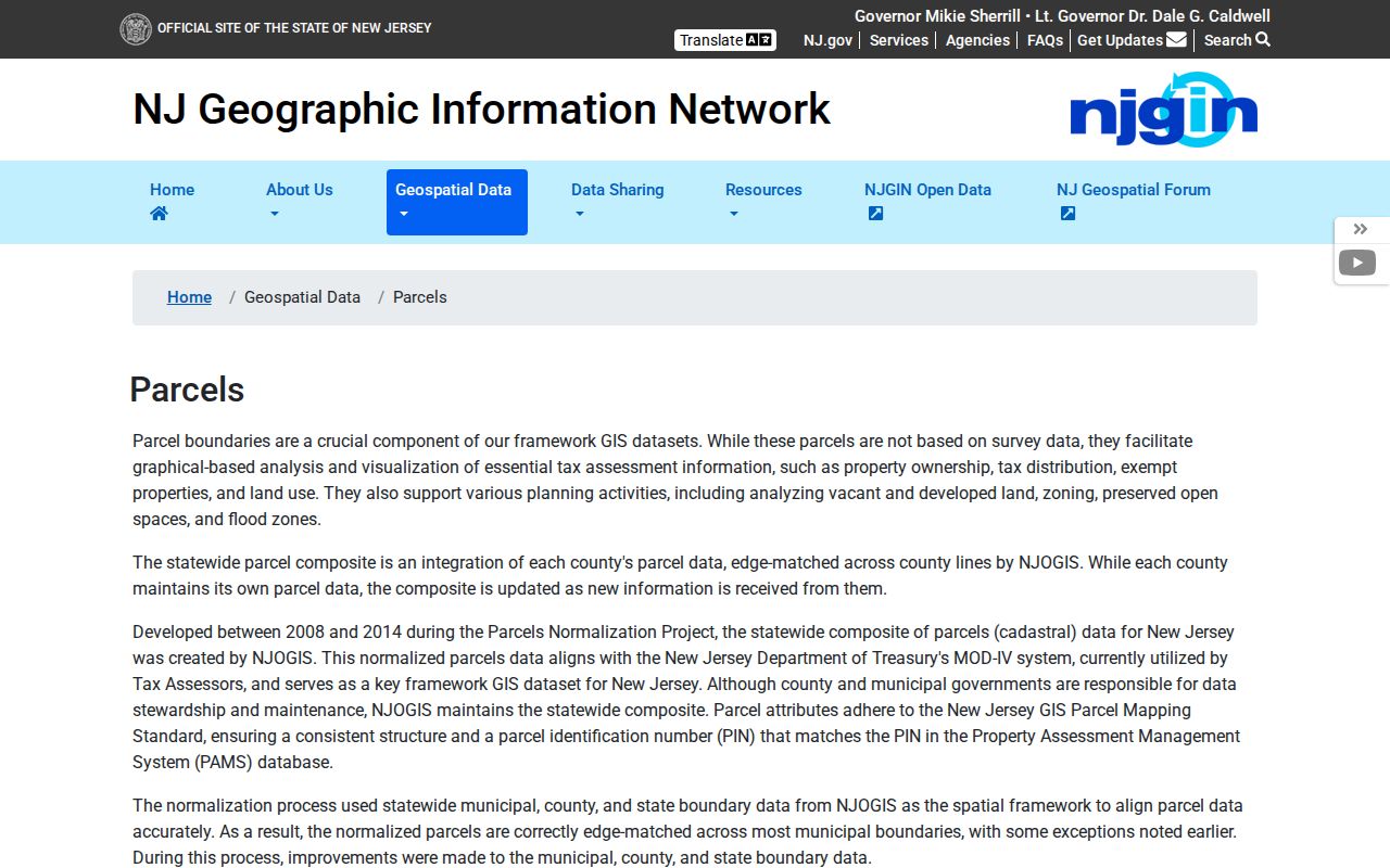
The NJGIN statewide parcel explorer offers a documented way to normalize a Bergenfield address when the local vendor screen is incomplete. It searches an address, county, municipality, block, or lot. The result should be treated as a geographic and property-reference check. The research did not capture a ZIP filter, a live parcel sample, or a complete owner display, and NJGIN warns that protected owner names may be redacted under Daniel’s Law.
| NJGIN input | Street-directory use | Important limit |
|---|---|---|
| Address | Find the mapped property from a standardized street address. | Confirm the street spelling and directional prefix first. |
| County | Keep the parcel search within Bergen County. | County geography is broader than the borough. |
| Municipality | Refine the result to Bergenfield. | Use it with the exact street address when possible. |
| Block and lot | Connect the mapped parcel to tax and deed references. | It is a property bridge, not a household listing. |
The NJGIN parcel page is the source for this search route and its documented inputs.
Once the municipality, block, and lot agree across sources, the next question is usually a dated recorded instrument, not a broad name search.
Bergenfield Street Directory Map Check
The County’s GIS route is valuable for checking parcel geometry, road labels, and neighboring parcel edges along a Bergenfield street. The county says its GIS parcel data is regularly updated, but the inspected interactive viewer did not expose a live parcel sample or text-captured field labels. Keep the map’s boundaries, road label, address, and block/lot separate from any name shown elsewhere. That distinction matters when an old directory, a tax record, and a deed use different kinds of address information.
The Bergen County Parcel Viewer provides the official map route for the street check. A map view can establish geographic adjacency when the viewer shows it, but it cannot establish a relationship between people at nearby parcels.
Bergenfield Street Number Rules
Bergenfield Chapter 124 makes Main Street and Washington Avenue the numbering origins. Streets running north from Main begin there, and crossing streets north and south of Main use the corresponding directional prefix. East-west streets begin at Washington Avenue and use East or West prefixes. The code also places even numbers on the southerly or westerly side and odd numbers on the northerly or easterly side. Each 20 or 25 feet of frontage is assigned a separate lot or number under the rule.
Before treating an old number as a different property, test its direction, parity, and relation to Main or Washington. The Building Inspector assigns numbers from an engineer map filed with the Borough Clerk, so an address question that cannot be settled online has an official municipal reference point. No complete official renumbering list was located.
Bergenfield Street Directory Deed Trail
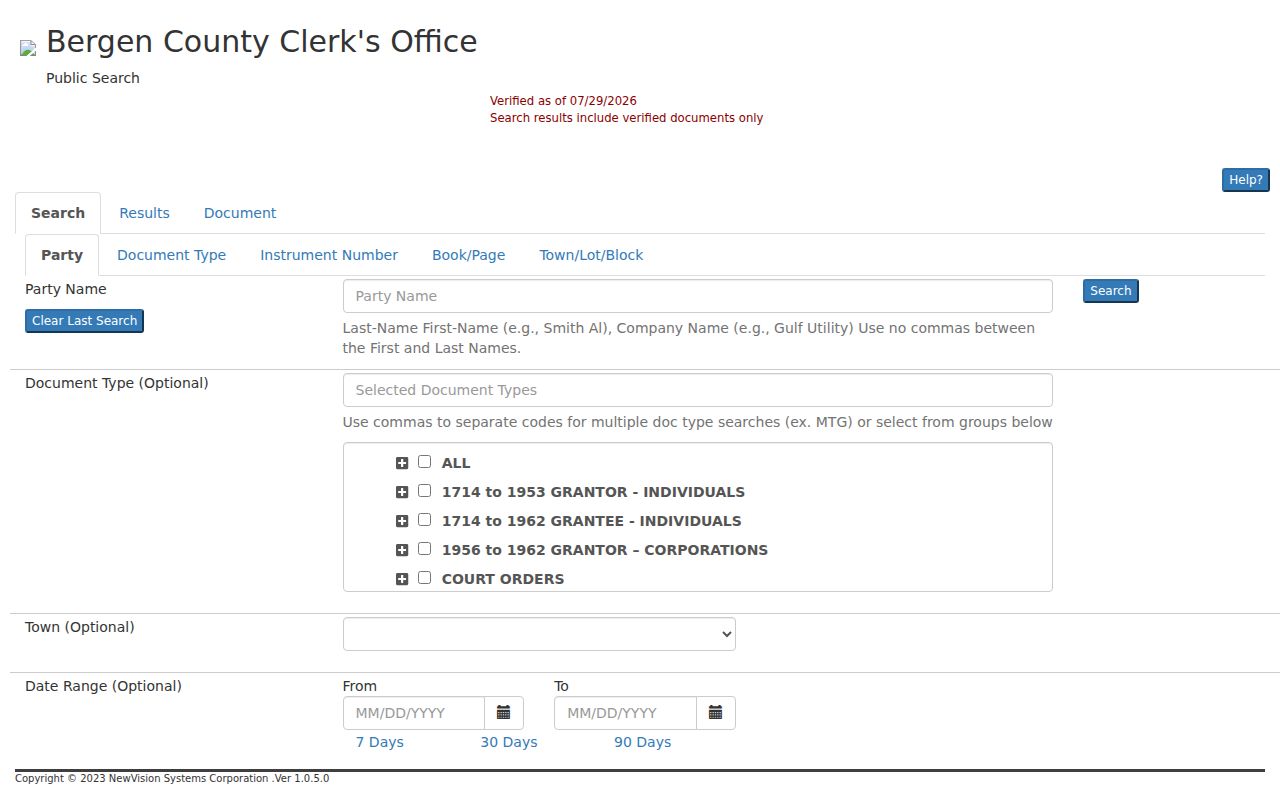
For a defined parcel, the county recorder route is the Bergen County Land Records Public Search, which covers recorded documents from January 1, 1970 to the present. The BrowserView search supports party names, document type, town, date range, instrument number, book/page, consideration, legal-description lines, lot/block, map, and parcel fields. It can connect a street address to a dated property instrument, but it does not identify every person at that address.
Search tip. Search a person’s variants with no comma. The county’s party-name search uses an automatic wildcard prefix and lets the searcher choose ALL or ANY names; additional parties can be added. A party name with no result may need a different order, initial, or entity spelling before the street record is considered incomplete.
| County land-record field | How it helps an address trail |
|---|---|
| Party Name / More Names | Tests grantor, grantee, and alternate spellings tied to an instrument. |
| Town and date range | Narrows an instrument search to Bergenfield and a known period. |
| Lot/block or legal description | Links an instrument to the property when a street label changed. |
| Book/page or instrument number | Returns to a specific recorded document or linked record. |
The County land-records BrowserView displays these documented search choices.
CAPTCHA, image restrictions, cart controls, or payment can limit access to images and printing even when the index is public. Record what was visible instead of assuming an image is free or unrestricted. For an instrument before the online coverage period, move to the County Clerk’s older-material route, the New Jersey State Archives, or the FamilySearch catalog and preserve the collection or reel reference.
Bergenfield Street Directory Record Coverage
Street-address research works best when each record set is used for its own narrow purpose. The following Bergenfield routes are complementary, and none turns a street address into a comprehensive list of residents.
| Address-keyed source | Custodian | What it can show | Documented access |
|---|---|---|---|
| Assessment and tax search | Bergenfield Tax Department | Assessment or account information on a stated date, plus defined tax-search results. | Local office; borough lists a $10 municipal tax search. |
| Parcel map | Bergen County GIS / NJGIN | Parcel geometry, road labels, block/lot, and mapped adjacency when displayed. | Public viewers with live-display and redaction limits. |
| Recorded land instrument | Bergen County Clerk, Registry Division | Grantor, grantee, legal description, instrument details, and recording date. | Public index from 1970; images or prints may be gated. |
| Voter-list record | Bergen County Clerk and State election system | Statutory registration information under disclosure rules. | State checker or written county request, with protected-address and use limits. |
| Permit or code file | Bergenfield Building Department or Code Enforcement | Address-keyed administrative records, if releasable. | Ask the proper custodian for a defined record type and period. |
A historic household source belongs beside, not inside, this current-record chain. The dated directory collections are treated in more detail on the Bergenfield City Directory page.
Note: A recorded deed party, assessment label, and directory entry answer different questions and should retain their own source dates.
Bergenfield Street Directory History Check
Street research often needs an older label or map before the parcel can be matched. The Bergenfield Library holds the 1926-1927 Twin Boro Directory, including large Bergenfield and Dumont maps, and the 1947 Know Your Bergenfield volume with residential-by-street listings. Its Bergenfield Street Names item is a 1996 source for name histories, not a complete renumbering table. The 1977 election-district map and 2001 tax map in the library finding aid offer later crosswalks.
The Princeton Sanborn selection identifies Bergenfield sheets from 1912, 1923, and 1928. Those maps can show whether the mapped use was a dwelling, store, school, church, or other building type at a historical date. They do not name every household and should not be used as an occupant list.
For a long street, compare a named corner, a mapped building footprint, and the legal description before connecting an early map to a modern parcel. This preserves the difference between a historical location clue and a documented transaction.
Bergenfield Street Directory Caution
Important limit. An old address that does not match a modern number has not automatically moved to a different parcel. Bergenfield research did not locate one official master list of street renumberings or name changes. A stronger approach pairs the 1926 directory map, the Chapter 124 numbering rule, the 1996 street-name source, and the deed’s legal description. If those sources do not align, retain the uncertainty and ask the Clerk or library reference staff for the relevant engineer map, tax map, or finding-aid item.
This careful cross-check also avoids confusing postal standardization with a legal property description. A current postal form, a historical street label, and a recorded legal line may all be useful, but they serve different purposes.
Bergenfield Street Directory Privacy Limits
Address-linked public records have firm boundaries. Daniel’s Law can remove protected home addresses from state, county, and local government websites, and NJGIN warns that an owner name may be redacted. Voter lists have protected-address exclusions. Motor-vehicle information, vital records, adoption information, juvenile matters, and sealed or expunged court files follow separate restrictions. A missing name, redacted owner display, or unavailable image may be the intended result of a protection, not a bad search.
Lawful use. Use Bergenfield street records for defined personal research, property history, family history, or civic questions. Do not use them to stalk, harass, intimidate, or target any person.
When a record is needed from the borough, submit a written, specific request under the New Jersey Open Public Records Act to the correct custodian. Ask for an existing record, date range, and address or block/lot, rather than asking an office to identify a person at an address.