
Bergenfield ZIP Code Directory Coverage
Bergenfield has one primary postal label for delivery research. The Postal Service consistently labels Borough government addresses with 07621, but that useful label is not a boundary map. Start with the exact address in the official USPS tool and retain the standardized output. The tool can correct a street form or supply ZIP+4, while the municipality, block and lot, and County parcel references answer separate questions. The nearby post-office labels below are context only, not a claim that they serve Bergenfield addresses.
| ZIP | Delivery area in this directory | Post office | Research note |
|---|---|---|---|
| 07621 | Bergenfield delivery area | Bergenfield Post Office, 25 Veterans Plaza | Primary row; confirm each address with USPS |
| 07628 | Adjacent postal context | Dumont Post Office | Do not assume Borough coverage |
| 07646 | Adjacent postal context | New Milford Post Office | Do not assume Borough coverage |
| 07670 | Adjacent postal context | Tenafly Post Office | Do not assume Borough coverage |
The Bergenfield Post Office listing identifies the local facility at 25 Veterans Plaza and supplies the adjacent postal context used here. USPS did not expose a full public 07621 polygon, a ZIP+4 street list, or a split history in the research. Note: retain a postal result as a label for a stated address and date, not as a municipal-coverage decision.
USPS Bergenfield ZIP Address Checks
The official USPS ZIP Code Lookup has two useful directions. Address-to-ZIP accepts a residential or corporate street address with city and state. ZIP-to-address starts with a ZIP and supports an address route. Use the first option when checking a complete Bergenfield address. Use the reverse option only as a postal aid, since it is not a resident roll or a Borough boundary service.
The standardized result can reveal a directional prefix, a corrected street spelling, or a ZIP+4. That makes it a good first check before searching a tax record, a county GIS map, or a historical directory. It does not reveal parcel ownership, who receives mail, who is registered at an address, or whether a name appears in a public record.
The USPS lookup interface is shown below with its postal search paths.
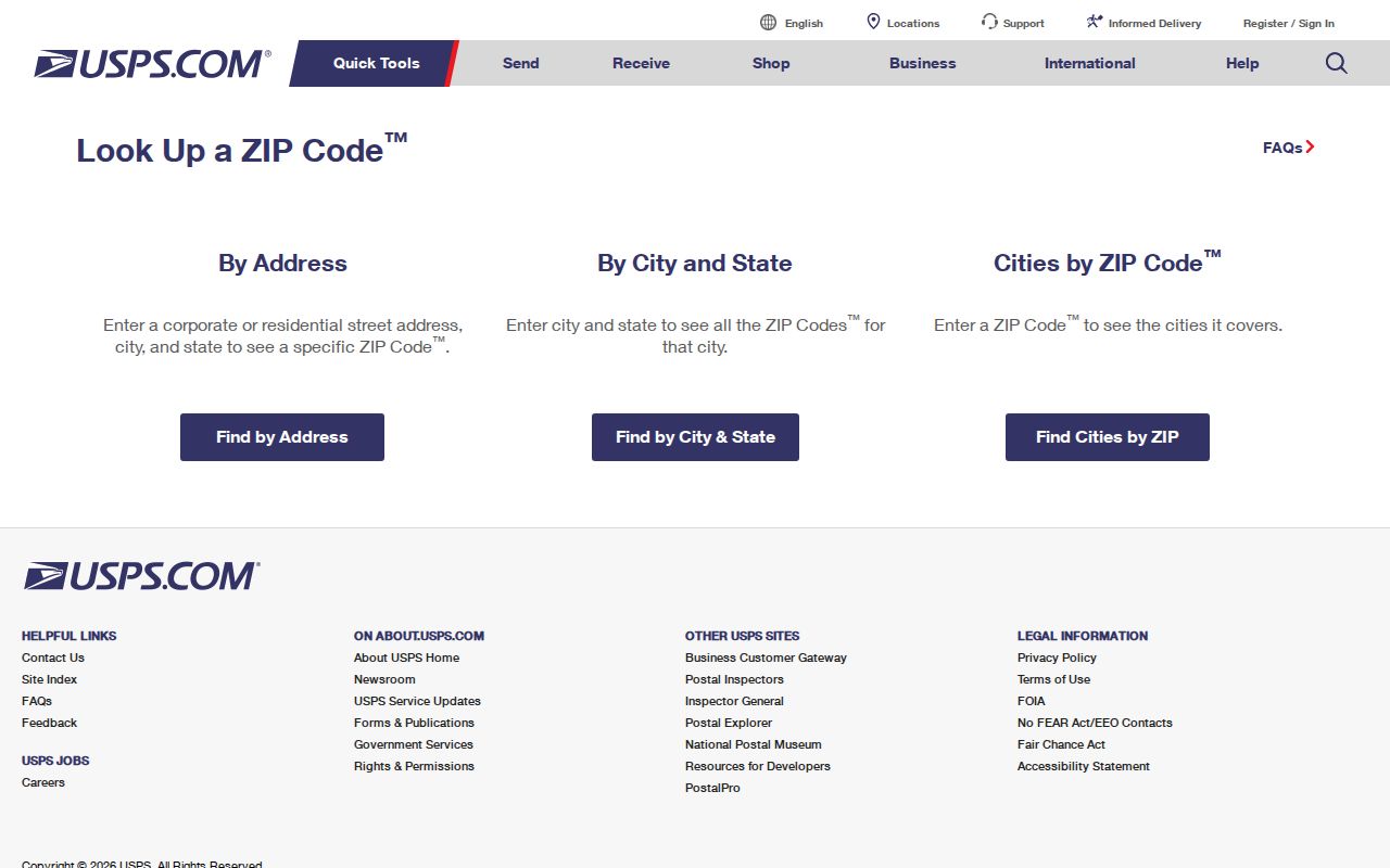
Enter the address as fully as possible and preserve the returned standardized form before carrying it to a County or Borough record search.
Bergenfield ZIP Search Fields
Postal search fields are intentionally narrower than property-search fields. USPS captures the street address, city, and state for an address-to-ZIP request. Its ZIP-to-address route begins with the ZIP. New Jersey’s statewide parcel explorer does not offer a ZIP filter in the observed interface. Instead, it searches address, county, municipality, block, and lot. That distinction prevents a common error: treating a postal number as if it were a parcel key.
| Official tool | Field or input | How it is used | Limit |
|---|---|---|---|
| USPS ZIP Lookup | Street address, city, state | Address-to-ZIP standardization | Postal result, not a Borough boundary |
| USPS ZIP Lookup | ZIP and address route | Reverse postal check | Not a resident list |
| NJGIN Parcel Explorer | Address, county, municipality | Move from place to parcel context | No ZIP filter observed |
| NJGIN Parcel Explorer | Block and lot | Confirm property reference | Live map fields can vary |
The missing ZIP field matters. Use USPS to normalize the address, then use address or block and lot in the parcel system. A ZIP-only search cannot reliably return every Bergenfield parcel because postal geography and municipal geography use different boundaries.
Narrow a Bergenfield ZIP Search
A useful ZIP code directory workflow moves from a postal label to a precise local identifier. It avoids treating 07621 as an all-purpose search key. It is not a property identifier, a local boundary, or proof about a named individual. The record systems documented for Bergenfield handle different parts of the work: USPS standardizes mail addressing, NJGIN and County GIS tie an address to property geography, the Tax Department routes local tax questions, and recorded land records identify dated instruments.
- Run the complete street address through USPS and record the standardized address, ZIP, and any ZIP+4 result.
- Enter that address in the NJGIN parcel explorer or County GIS route to find the municipality, block, and lot.
- Use the block and lot, not the ZIP alone, for a Bergenfield Tax Department question or a County property record check.
- For a recorded transaction, search the County Clerk index by town, party, lot and block, or a date range, and retain the instrument details.
- Compare an old street listing with its printed date before drawing any current conclusion.
Once a ZIP points to a particular street, the Bergenfield street directory provides the fuller street and address workflow.
Bergenfield Parcel Routes Use Blocks
The State’s NJGIN parcel explorer offers address, county, municipality, block, and lot inputs. It is the bridge from a USPS-formatted address to property geography. The County GIS route can add parcel boundaries, road labels, and adjacent-parcel context. Research did not capture a live Bergenfield parcel result, so no particular owner field or map display should be assumed. Owner names may also be redacted under Daniel’s Law.
For a live Borough tax question, the Bergenfield Tax Department lists a $10 municipal search for unpaid taxes, open permits, and pending added or omitted assessments when requested by exact address or block and lot. That is a dated local administrative response, not proof of current occupancy or legal title. Compare it with a County Clerk instrument when the question concerns a recorded transaction.
The NJGIN parcel explorer shows the official parcel-search entry point. Use the returned parcel identifiers as the handoff between a postal lookup and a local property record, while keeping their dates and purposes distinct.
Bergenfield ZIP Voter Routes
A ZIP code does not replace the election district or exact name used by New Jersey’s voter system. The State registration checker is an exact-name status route, with matching affected by spaces, hyphens, middle initials, nicknames, and name changes. A result is a dated election record. It does not prove that a person currently receives mail at a particular ZIP, owns a parcel, or has lived continuously at an address. Use the street and municipal details from USPS and parcel tools to decide which official question to ask next.
For a defined government-record need, the Bergen County Clerk accepts written requests for voter lists. The request should identify the municipality, district, list type, and date instead of treating the ZIP code directory as a roster. The County Clerk’s published examples include $0.25 per district for registered-voter lists and $0.25 per page for vote-by-mail lists. Protected addresses and statutory use restrictions still apply. This is a fallback route when a narrow, dated election record is needed, not a shortcut around privacy rules or a substitute for the address-to-parcel chain.
Note: postal, election, and property records should remain separate evidence streams until their dates and identifiers align.
Bergenfield Numbering Resolves Addresses
Chapter 124 of the Bergenfield code is a local address check that helps when USPS, an older directory, and a parcel map seem to use different forms. Numbers on streets running north from Main Street begin at Main. North and South prefixes apply across the Main Street reference. East-west streets begin at Washington Avenue, with East and West prefixes. Even numbers are assigned to the southerly or westerly side, while odd numbers are on the northerly or easterly side.
Address check. Before treating an old Bergenfield listing as a different place, check its street direction and number parity. Then compare the 1996 Street Names resource, a tax map, and a legal description. No complete official renumbering table was found, so a similarity in number alone is not enough to merge two historical addresses.
Bergenfield ZIP Codes and Borough Lines
ZIP codes route mail. Borough boundaries govern municipal records. USPS expressly warns that its boundaries do not necessarily follow municipal lines, and the research found no public polygon that defines all of 07621. The correct local use is modest: 07621 is the primary Bergenfield delivery label documented by the Postal Service, while each actual address still needs verification. Adjacent Dumont, New Milford, and Tenafly post-office labels are useful orientation points, not coverage claims.
- ZIP code
- A Postal Service routing label for an address or delivery area. It is not a municipal boundary or parcel number.
- ZIP+4
- An added four-digit postal detail that narrows delivery handling for a standardized address.
- PO box ZIP
- A ZIP associated with post-office-box delivery; it should not be assumed to identify a street delivery area.
- Carrier route
- A postal delivery grouping used for mail operations, not a public resident directory.
Note: use a ZIP as a postal check, then rely on municipality, block, lot, and legal description for property research.
Postal Gaps in Bergenfield ZIP Research
Boundary note. A Bergenfield ZIP label is not evidence that an address lies inside Borough limits, and a nearby municipal address may use a different postal arrangement. USPS provides the official standardized result, but not a complete public ZIP polygon or a historical split record for 07621. A failed match can also arise from a missing directional prefix, an old street form, or a spelling difference.
For a historical location, compare the 1926 directory maps, the 1947 residential-by-street listings, the 1977 election-district street map, and the 1912, 1923, or 1928 Sanborn sheets as needed. Those sources can orient a dated place. They cannot establish a current delivery address or name a current resident. Keep a record of the source date, the postal form searched, and any uncertain address bridge.
The Bergenfield Post Office page shows the local postal facility used for this ZIP code directory.
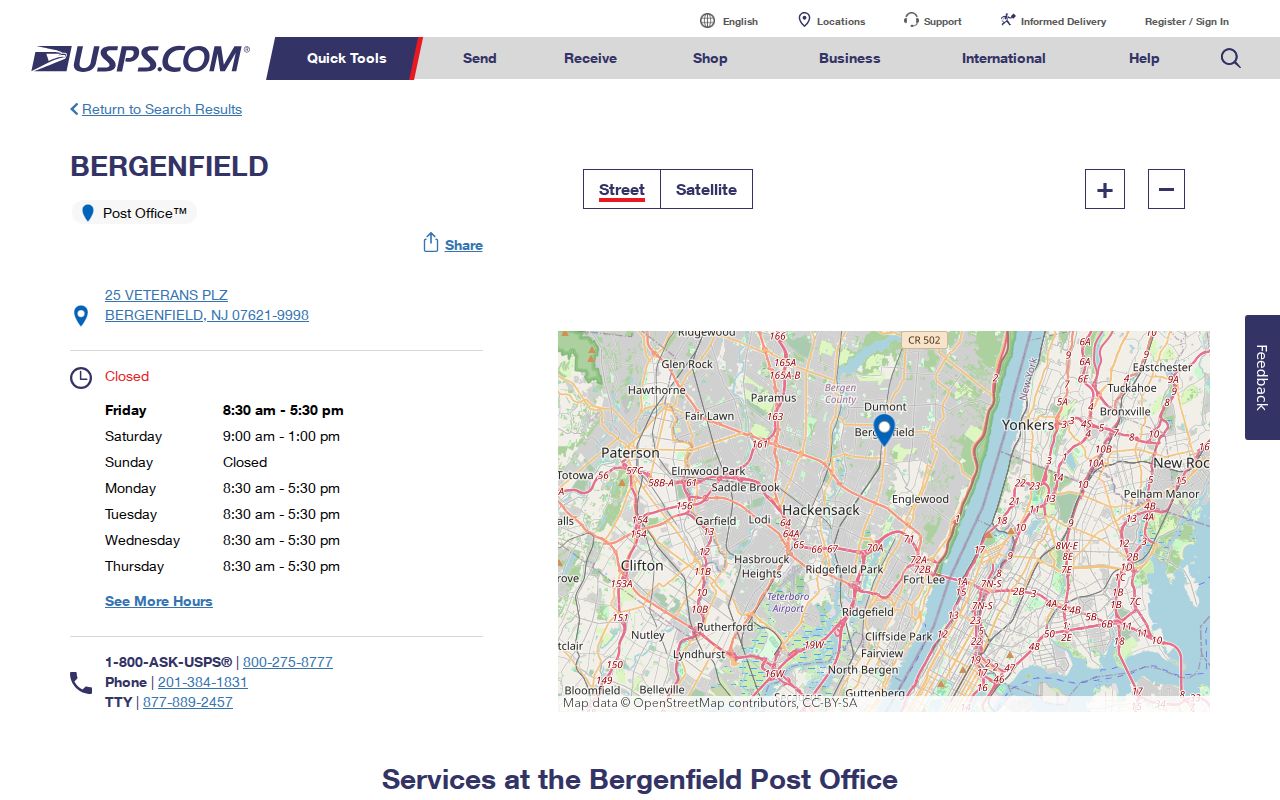
The facility listing supports the local postal context, while the individual address lookup remains the correct tool for a specific ZIP check.